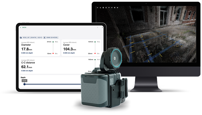
See inside any concrete structure with our 3D scanning technology. Get precise reinforcement data and advanced analytics within minutes and reduce risks, cut costs, and accelerate project timelines.
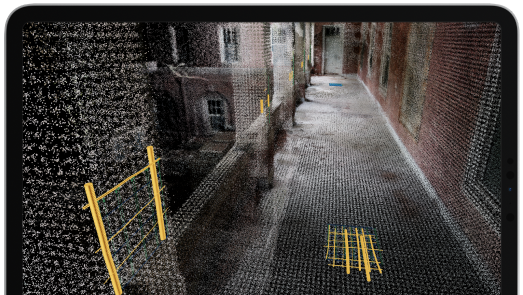
A BIM-compatible point cloud positioning and documenting the GPR scans automatically, instantly accessible in the field, in the office afterwards and shareable with your colleagues and clients.
Exportable to BIM
Fast and automatic documentation
Rapid analysis platform
Our platform is extracting signals from the GPR radars and automatically analyzing and visualizing the results in less than a minute.
Shareable and exportable data
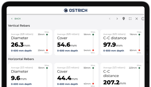
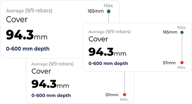
Diameter precision: 1-3 mm
Cover precision: 1-3 mm
product elements
3D reinforcement insights
A BIM-compatible point cloud positioning and documenting the GPR scans automatically, instantly accessible in the field, in the office afterwards and shareable with your colleagues and clients.
Exportable to BIM
Fast and automatic documentation
Rapid analysis platform
Our platform is extracting signals from the GPR radars and automatically analyzing and visualizing the results in less than a minute.
Shareable and exportable data
Diameter precision: 1-3 mm
Cover precision: 1-3 mm
how it works
01
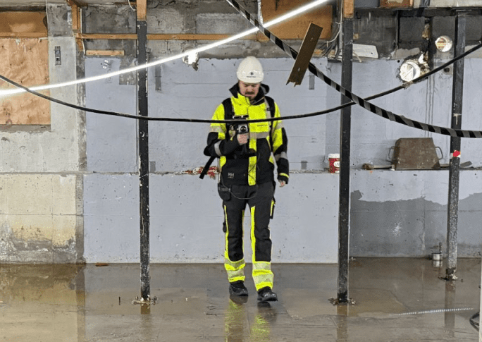
collect data
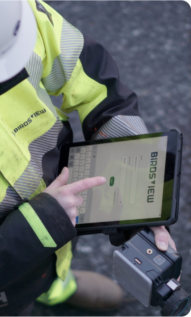
Capture comprehensive data using our handheld scanner that integrates Ground-Penetrating Radar (GPR), Lidar, and a high-resolution camera.
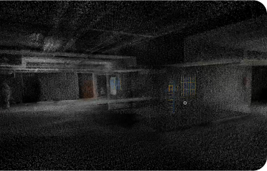
As we scan the concrete structure, our system automatically generates a detailed 3D point cloud, creating a precise digital twin of the environment with all measurements.
02
Receive Instant Analysis
Get reinforcement insights in just a minute. Our AI-backed algorithms instantly and automatically analyze the GPR data to determine rebar locations, cover, and diameter with high precision.
This replaces subjective and time-consuming manual interpretation with objective, immediate results.
03
Use 3D Visuals & Analytics
Access all data through our web-based platform where insights are clearly visualized within the 3D point cloud. The user-friendly interface is designed for everyone on the project team, not just experts.
Seamlessly import the data into your existing BIM or 3D models to enhance project planning, reduce execution risk, and make data-driven decisions.
Applications
Project planning
Get key structural data early in your project to improve tender accuracy, maximize material reuse potential, and significantly reduce execution risk.
Retrofitting
Reveal precise rebar details to accurately assess structural load capacity, which cuts uncertainty, saves time, and lowers project costs.
Maintenance
Use detailed reinforcement data to execute smarter repairs, safeguard long-term structural integrity, and create proactive maintenance plans.
Cutting and coring
Pinpoint rebar, conduits, and other objects before you cut or core to avoid hits, ensure worker safety, and prevent costly mistakes.
our users
our users
Public & private asset owners
Safeguard the long-term structural integrity of your assets and enable smarter maintenance planning with data-driven repairs. You can improve tender accuracy, reduce project budgets, and lower execution risk by maximizing the reuse potential of existing materials.
Structural engineers
Efficiently generate insights to assess structural load capacity and avoid costly mistakes in your analysis. By accessing advanced data, you can maximize material reuse in your projects and win more tenders by offering innovative, sustainable solutions.
Construction companies
Reduce execution risk and prevent costly mistakes by cutting uncertainty with clear, upfront structural data. Accessing these advanced insights allows you to maximize material reuse and win more tenders with competitive and sustainable bids.
Survey & monitoring companies
Increase your service efficiency by delivering precise, BIM-compatible documentation that cuts project uncertainty and risk for your clients. Offering these advanced insights gives you a competitive edge to win more tenders and modernize your service offerings.
Hardware & sensors
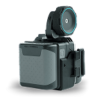
3D tracker
3D tracker combines LiDAR and a camera to deliver efficient, high-precision measurements of the surrounding environment.
Efficient mapping of complex environments
Viewing range: 40 meter in 360 degrees
Real-time tracking and positioning
Robust performance in varying lighting and surface conditions
High accuracy: generates dense point clouds with centimeter surface detail and minimal noise, capturing edges and surfaces with high clarity
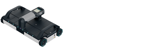
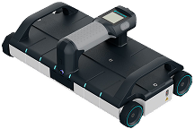
Large GPR
Large GPR scanner, the Proceq GP8100, is ideal for efficiently covering large areas. It can easily scan entire floors, decks, and similar surfaces.
Highly productive
Scan width: 25 cm
Penetration depth: up to 80 cm
One scan equals six scans with the small GPR
large GPR
Large GPR scanner, the Proceq GP8100, is ideal for efficiently covering large areas. It can easily scan entire floors, decks, and similar surfaces.
Highly productive
Scan width: 25 cm
Penetration depth: up to 80 cm
One scan equals six scans with the small GPR
small GPR
Small GPR scanner, the Proceq GP8800, is perfect for scanning in tight or hard-to-reach areas. Its lightweight and cordless design makes it highly portable and easy to handle on vertical or overhead surfaces.
Compact and versatile
Penetration depth: up to 65 cm
Ideal for walls, beams, and confined spaces
small GPR
Small GPR scanner, the Proceq GP8800, is perfect for scanning in tight or hard-to-reach areas. Its lightweight and cordless design makes it highly portable and easy to handle on vertical or overhead surfaces.